Cheia | Comuna: Grădina | Judeţ: Constanţa | Punct: Peştera La Baba | Anul: 2011
Descriere:
Raport ID:
4706
Anul cercetarii:
Perioade:
Preistorie; Protoistorie; Antichitate; Evul Mediu;
Epoci:
Neolitic; Eneolitic; Epoca bronzului timpuriu; Epoca bronzului; Hallstatt; La Tène; Epoca greacă; Epoca elenistică; Epoca romană timpurie; Epoca romană târzie; Epoca medievală timpurie; Evul Mediu;
Categorie:
Domestic;
Tipuri de sit:
Aşezare deschisă; Aşezare rurală; Locuire în peşteră;
Cod RAN:
| 63018.05 |
Județ:
Constanța
Unitate administrativă:
Grădina
Localitate:
Cheia
Punct:
Peștera La Baba
Localizare:
| 63018.05 |
Instituții și
Persoane implicate:
Persoane implicate:
| Nume | Prenume | Rol | Instituție |
|---|---|---|---|
| Caraivan | Glicherie | participant | GEOECOMAR CONEXIF |
| Ştefănescu | Diana | participant | Universitatea Bucureşti |
Raport:
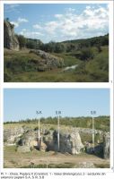
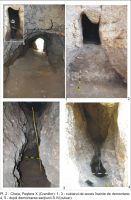
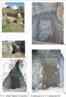
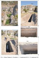
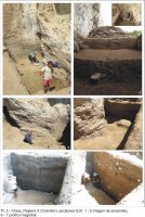
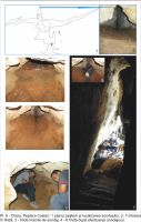
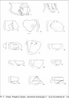
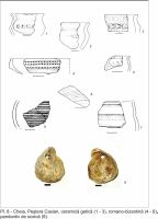
The Dobrogea district lies in the southeastern part of Romania, between the Danube River and the Black Sea. Its central part exhibits a gentle relief, whose higher parts mark the extent of the areas exposing the Casimcea Formation limestones. The Central Dobrogea is a distinct structural unit of the Moesian Platform, separated from the adjacent North and South Dobrogea units by deep faults. Its highly folded Precambrian basement (the Green Schists Formation: an Upper Precambrian, anchymetamorphic, fl ysch series) underlies a rather thin sedimentary cover, composed of two structural stages: a lower, slightly folded cover encompassing two Middle Jurassic calcareous formations as well as the relatively thick Upper Jurassic Casimcea Formation, and an upper, undislocated cover including several scattered patches of Middle and Upper Cretaceous deposits. Most of the thickness of the platform cover in the Central Dobrogea is accounted for by the Casimcea Formation. The Quaternary, rather thick, loess cover hides the Jurassic formations and their basement over broad areas. In the lower part of the section (3,70 – 2,65 m) a Neolithic layer has been identifi ed. The fi ssures of the bedrock (Upper Jurassic limestones) are fi lled with small fragments of altered limestone in a residual sandy-clayey yellow matrix, washed from the micro-atoll core fi lling. Coarse fraction contains rare coal, bones fragments, very well rounded quartz grains, and organoclasts of sponges, brachiopods, corals, and algae. Inside the Neolithic horizon a reddish “fi replaces” level was discovered, containing coal, burned clay and bird bones. The next level, N 4, (2, 65 – 2,45 m), dated as Bronze/ Hallstatt age, is represented by the same sandy – clayey yellowgrey matrix with angular limestone fragments and goat bones and teeth. The level N 5 (2,45 – 2,35 m) is a sandy-clayey grey – yellow material with few pottery fragments(Hallstatt ?).
The last three level are similar lithologically, but differ by their archaeological content: level 6 - Hallstatt (2,35 – 1,85 m level); level 7 - Romano – Byzantine (1,85 – 1,20 m); level 8 – Late Medieval to
modern times (1,20 – 0,00 m).
The shelter - cave from “La Baba” was inhabited since the Neolithic time. The inner space was gradually fi lled with heterogeneous, sandy – clayey residual material, washed from the sedimentary fi lling of the micro-atoll. No sedimentological particularity was revealed. Several settlements succeeded, leaving their traces on this bed.


 CC BY-SA 4.0