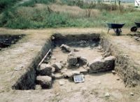
Adamclisi | Judeţ: Constanţa | Punct: Cetate | Anul: 2003
Descriere:
Titlu raportului:
Results from the 2003 surveying program in the territorium of Tropaeum Traiani, Adamclisi, SE Romania
Raport ID:
2145
Anul cercetarii:
Perioade:
Preistorie; Protoistorie; Antichitate; Evul Mediu;
Epoci:
Neolitic; Eneolitic; Epoca bronzului timpuriu; La Tène; Epoca romană timpurie; Epoca romană târzie; Epoca migraţiilor; Epoca medievală timpurie; Evul Mediu;
Categorie:
Apărare (construcţii defensive);
Tipuri de sit:
Cetate;
Cod RAN:
| 60892.08 |
Județ:
Constanța
Unitate administrativă:
Adamclisi
Localitate:
Adamclisi
Punct:
Cetate
Sector:
Cetate, Teritoriul Rural - Șipote, Abrud
Toponim:
Tropaeum Traiani
Localizare:
| 60892.08 |
Instituții și
Persoane implicate:
Persoane implicate:
| Nume | Prenume | Rol | Instituție |
|---|---|---|---|
| Ionescu | Mihai Severus | participant | Baza 90 Transport Aerian Otopeni |
| Achim | Irina Adriana | participant | Institutul de Arheologie "Vasile Pârvan", Bucureşti |
| Barnea | Alexandru | participant | Institutul de Arheologie "Vasile Pârvan", Bucureşti |
| Barnea | Ion | participant | Institutul de Arheologie "Vasile Pârvan", Bucureşti |
| Mărgineanu-Cârstoiu | Monica | participant | Institutul de Arheologie "Vasile Pârvan", Bucureşti |
| Bogdan Cătăniciu | Ioana | participant | Institutul de Arheologie şi Istoria Artei, Cluj-Napoca |
| Gămureac | Emilian | participant | Ministerul Culturii |
| Constantin | Robert | participant | Muzeul de Arheologie "Callatis", Mangalia |
| Lungu | Liviu | participant | Muzeul de Istorie Naţională şi Arheologie Constanţa |
| Papuc | Gheorghe | participant | Muzeul de Istorie Naţională şi Arheologie Constanţa |
| Talmaţchi | Gabriel | participant | Muzeul de Istorie Naţională şi Arheologie Constanţa |
| Scurtu | Florin | participant | SC GEI PROSECO SRL, Bucureşti |
| Ştefan | Călin Dan | participant | SC Net4You SRL Bucureşti |
| Ionescu | Mihai | participant | Şcoala Generală 3 Mangalia |
| Arsenescu | Margareta | participant | Universitatea Bucureşti, Facultatea de Istorie |
| Căpiţă | Carol | participant | Universitatea Bucureşti, Facultatea de Istorie |
| Ghica | Ana-Maria | participant | Universitatea Bucureşti, Facultatea de Istorie |
| Olariu | Cristian | participant | Universitatea Bucureşti, Facultatea de Istorie |
| Silberstein | Gil | participant | University of San Francisco |
Raport:
In 2002, a surveying program was initiated in the region (territorium) surrounding the Roman city of Tropaeum Traiani. The long-range research goals are to document and survey all known or suspected sites within a 25 km radius of this Roman city and to produce a detailed land use map of the territorium for the period during which Tropaeum Traiani was occupied (2nd - 6th centuries AD). The expected end product of this investigation is to understand the nature and extent of the Late Roman settlement system; the functions of, or activities at, these rural sites; and the urban-rural economic interrelationships both among sites within the territorium and between Tropaeum Traiani and its surrounding settlements. The survey consists of two, parallel investigations: first, to conduct soil phosphate surveying at known but unexcavated sites dating from the 2nd to the 6th centuries; secondly, to record GPS (Global Positioning Satellite) data for known archaeological sites of this period for eventual mapping using GIS (Geographic Information Systems).
Based on successful results from the 2002 season, the 2003 season was focused on a more intensive investigation of two sites—Abrud and Şipote—both of which are of interest because of their location on subterranean Roman aqueduct lines. In 2003, we were able to conduct both surface surveying and soil surveying at Şipote (ca. 5 km south of Adamclisi); at Abrud (ca. 7 km north of Adamclisi), limited time and staff permitted only surface surveying.
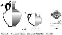
Both Abrud and Şipote have Roman-period aqueduct lines exposed at the surface as a result of erosion and historic/recent interventions and remodeling. In addition, both sites have vast settlement areas. Standard walking surveys were conducted at both sites and surface finds were collected. Surface pottery, which was identified by dr. A. Barnea, represented the following chronological periods at both Abrud and Şipote: Neolithic, pre-Roman Iron Age ("La Tene"), Roman period, Early Medieval, Late Medieval, and Historic period. At Abrud, a member of our team (Randolph Bragg) made an unusual discovery: a well preserved amphora handle with a Greek inscription, tentatively dated to the 3rd century BC.
In 2003, we undertook a soil phosphate survey at Şipote with the objective of identifying meaningful areas of this vast settlement to excavate in future field seasons. This site is important for two reasons: 1) surface pottery from the Neolithic to the Historic period has been found; and 2) its Roman aqueduct supplied water to the Roman city of Tropaeum Traiani. The settlement area occupies a large plateau and, since it has never been excavated, its area of occupation/utilization is preliminarily estimated at more than 0.5 km2.
Because of the longevity of phosphate in the soil and its indication of human activity, analysis of the presence and quantity of phosphate has proven an excellent method for locating and/or verifying archaeological sites1. In combination with walking surveys and documentation of artifacts at the surface or from the plough zone, phosphate surveying can identify previously unknown or confirm suspected areas of archaeological interest. Furthermore, phosphate analysis is exceptionally useful and important for determining the areal extent of known archaeological sites2. Soil phosphate testing was selected as a survey technique at Şipote for the following reasons: phosphate analysis is able to detect human occupation and utilization of the land on sites with or without remaining buried architecture. Furthermore, phosphate analysis is a rapid, inexpensive colorimetric technique that can be easily used in the field.
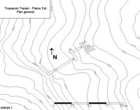
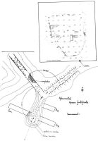
Within the limited timeframe of two weeks, our team laid out a survey line, collected soil samples, and performed the phosphate assays during the 2003 field season. Since the site is considerably vast and our time was limited, we decided to establish a survey line which cut across the largest, continuous area with the greatest concentration of ceramics that had been collected from the surface. Since the site comprises primarily a featureless, unploughed grassy terrain, we took the concentration of stone walls and other stone constructions along the western edge of the site as a basis for establishing a datum point and orienting our survey line. The survey line extended 750 m, NNW-SSE, and soil samples were taken at 25 points, 30 m apart. Additional soil samples were taken at points 1, 5, 10, 15, 20, and 25 at a distance of 30 m to the east and 30 m to the west of the main survey line. Point 1 was located at the edge of a steeply eroded slope; point 25 was located just beyond the electrical power lines. Points 24 and 25 may have been subject to soil disturbance from installation of the power lines, yet still yielded surface pottery.
Soil samples were collected by boring a steel soil sampling tube 2.5 cm in diameter to a depth of approximately 30 cm (to reach the end of any possible plough zone and to retrieve the entire ‘A horizon’ of the soil profile). The resulting core of soil was not touched by hands henceforth. The surface ‘root zone’ of the soil was discarded and the remainder of the soil core put into a plastic bag and sealed. After soil collection, each sample was air dried on a clean sheet of paper or plastic for 24 hours. All foreign organic and inorganic matter (e.g., plant roots, stones, leaves, shell) was removed from each sample before testing. Only 1.5 g of soil was needed for a single phosphorus assay (in the method described below).
The phosphorus was chemically separated from the soil by mixing 1.5 g of soil with 6 ml of phosphorus extracting solution in a sealed test tube for one minute. After the soil had settled, 3 ml of cleared solution was carefully drawn off into another test tube, and 0.5 ml of phosphorus indicator reagent was thoroughly mixed into the soil phosphate extract. A phosphorus test tablet was then mixed into this solution until dissolved. The result was a change in the color of the solution based on the amount of phosphorus present This quick colorimetric, molybdate test for phosphorus provided qualitative results only (i.e., trace, low, medium, or high concentrations) which are more than adequate to assess past human occupation or other utilization of the land.
Based on the results below, the entire area surveyed appears to represent a major area of settlement, strategically located on a high plateau, with a clear view of the valley below the western slope. Since the area surveyed is currently public land and does not appear to have been ploughed for a significant period of time, we anticipate little soil turbulence to have affected the results. Areas with soil phosphate of medium to high readings are, therefore, promising for excavation. Points 14, 15, 18, and 19 yielded results of either very low readings or barely trace amounts of soil phosphate, which may identify areas underutilized or otherwise inaccessible to human activity. For the 2004 field season, we plan to excavate test trenches cross-cutting areas with both high phosphate results and stone wall constructions.
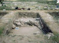
At Şipote, the focus of more intensive exploration in 2003, surface pottery from the aforementioned chronological periods was found over an extensive area measuring ca. 0.5 km2. In addition, numerous stone constructions protrude at the surface along the western edge of the settlement, overlooking a valley. At least two stone walls are apparent, one of which runs a course of ca. 300 m. Other archaeological features project at the surface, including two circular stone constructions of unknown function. The source of this stone is suspected to be medieval-period spolia taken from the city of Tropaeum Traiani; however, this hypothesis needs to be verified by excavation and geological comparison of the building materials.
In the course of conducting walking surveys, GPS data (latitude, longitude and elevation) were collected for strategic points at Şipote, Abrud, and Tropaeum Traiani as part of a larger effort to record the course of the subterranean aqueducts. The Roman aqueduct at Şipote had been previously identified by Al.-S. Ştefan (1972) and established to have supplied water to Tropaeum Traiani. However, GPS elevation data recorded for the exposed portions of the aqueduct line at Abrud indicate that it is unlikely for this aqueduct to have supplied water to Tropaeum Traiani. Furthermore, of the points surveyed at Abrud, it appears that one section (pt. 4) is at an elevation and direction off course from the other exposed points. Whether this section was a later diversion, a bend in the course, or a secondary line remains for future investigation. This leaves the unanswered, yet very interesting, question as to the destination and purpose for the aqueduct at Abrud.
We are grateful to Prof. Dr. Alexandru Barnea, the Archaeological Commission, and the Ministry of Culture in Romania for permission to conduct a field school and research at Tropaeum Traiani, Şipote and Abrud. Participating members of our team for the 2003 season include our photographer Gil Zilberstein (San Francisco) and the following volunteers and students (in alphabetical order): Randolph Bragg (Arlington, Virginia), Craig Caldwell (Princeton University), Prof. James Nafziger (Willamette University, Oregon), Adam Schneider (University of Oregon), Tyler Sterkel (San Francisco), and James Stockbridge (Oxford University). Funding for this project was provided by the above-mentioned students and volunteers in our field school through the non-profit organization, Terra Europaea, Inc.


 CC BY-SA 4.0